Top 20 Most Instagrammable Photo Locations in New Zealand
New Zealand is a country known for its spectacular scenery so it’s no surprise there are some phenomenal photo locations in New Zealand where you can take awesome pictures. This post is your definitive guide to the most Instgrammable places in New Zealand as chosen by professional travel content creators.
To keep it fair, about half of these spots are in the North Island and just over half in the South Island and they’re roughly ordered north to south. So wherever, you’re planning to focus your New Zealand travels, there are plenty of incredible New Zealand photo locations to add to your itinerary.
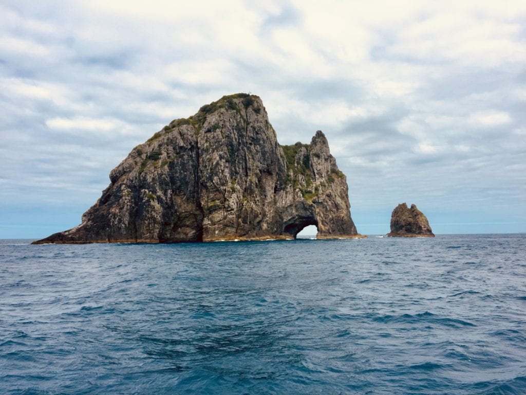
Hole in the Rock, Bay of Islands
“The Hole in the Rock” is a memorable New Zealand Instagrammable destination located in the Bay of Islands at the top of the North Island. The island is called Motukokako or Piercy Island. It can be reached by boat from Paihia or Russell.
It is often part of a larger boat tour that also visits other islands in the Bay of Islands. A typical tour will last about three hours.
Hole in the Rock features, as the name suggests, a hole in the face of a massive rock jutting out of the sea. Small boats can venture through the hole, which makes for an even more dramatic picture or video of the experience.
The high vertical walls of the rock and the cave-like opening of the hole within it combine to create an effortlessly photogenic moment. Dolphin encounters are also common and an added bonus when travelling to the site.
The summer months of December to February are generally the best time of year to visit Hole in the Rock because of the warm, sunny weather.
By Merry Allison of Virginia Vacation Guide
Hamilton Gardens
The Hamilton Gardens make such a popular photo location that on weekends you’ll often find couples taking their wedding photos in the gardens.
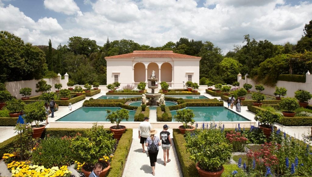
There are dozens of gardens in the complex which are all themed based on a part of the world, period of history or type of plant life.
The best gardens for photos are the Italian Renaissance Garden (photo below), Indian Char Bagh Garden and New Ancient Egyptian Garden. If you want something a bit quirkier, try the Surrealist Garden which looks straight out of Alice and Wonderland.
Entry to the gardens is free although it’s best to check the Gardens website ahead of time as occasionally some gardens are closed for private events. They also have some tips for which gardens look best at each time of year so you can plan your trip (and outfits).
Hamilton Gardens is one of the most unique photo locations in New Zealand and a must-do on any day or weekend trip to Hamilton.
Hobbiton Movie Set, Matamata
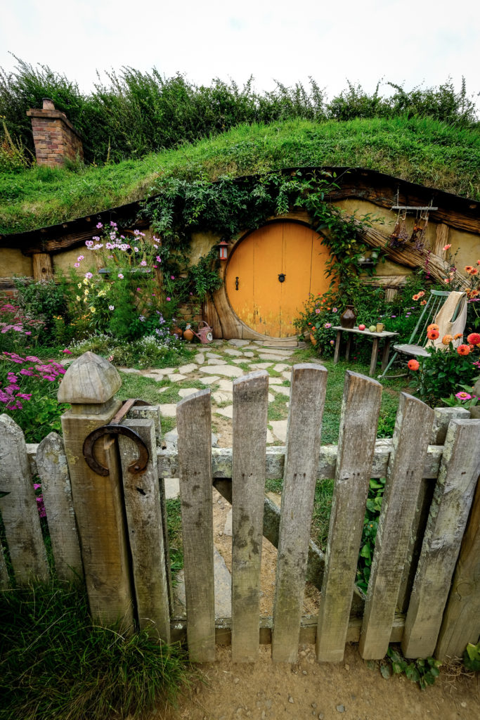
One of the most photogenic and Instagrammable places on the North Island would have to be the movie set of Hobbiton (also known as the Shire) from the popular ‘Lord of the Rings’ film series.
It’s a lot of fun to tour the village and take pictures of the homes. In the movies, this village was the home of the friendly protagonists, and the Hobbiton movie set today has 44 hobbit homes, farms, and gardens, and covers 5 hectares (12 acres)!
Any time of year is okay for a visit, and you don’t have to do any hiking to see the movie set, it’s just an easy walk. However, you do need to pay for tickets.
You can drive there yourself (it’s located 2 hours from Auckland), include it as a stop on a Waikato road trip, or there are also day tours by bus from Auckland. All in all, the Hobbiton movie set is one of the best places in New Zealand for photos!
By David & Intan of The World Travel Guy
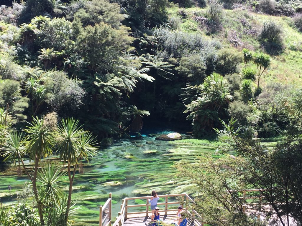
The Blue Spring, Putaruru
Make sure your phone is fully charged for this one as you’ll be frantically clicking trying to decide which is most beautiful – the pool of the Blue Spring itself, or the bright turquoise streams, complete with cute floating birds, that flow from it.
The Blue Spring is an underground freshwater spring that bubbles up into a picturesque pool. When sunlight hits the water a certain way it turns it the bright blue that gives it its name.
The Blue Spring is located a short drive from the towns of Tirau and Putaruru and easily accessed as a day trip from Auckland, or a stop on the way to or from Rotorua or Hobbiton.
Two walks along a path known as the Te Waihou Walkway lead to the main pool – the 5km route which actually takes about three hours round trip, or, the easy option – the 15-20 minute (each way) walk from the car park on Leslie Road. Both walk you past gorgeous hills and clear bright blue water until you reach The Blue Spring itself.
By Helen from Japlanease
New Chums Beach, Coromandel
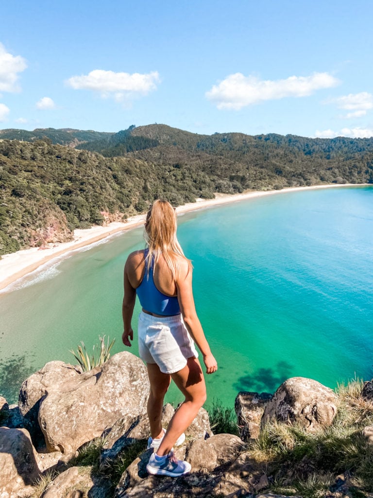
The New Chums Beach lookout is one of the best photo locations in the North Island. It’s located in the Coromandel Peninsula and is only accessible by foot. The walk itself takes no more than half an hour each way and is relatively easy.
Starting at Whangapoua Beach, you’ll walk to the beach’s northern end until you cross a stream. This stream is best crossed two hours on either side of low tide so bear that in mind when planning your trip.
Next, you’ll walk across the rocky shoreline until you reach the dirt track so best you have a pair of sturdy shoes with you.
The lookout itself is located on your right before you reach the beach. The 72-metre-high summit is steep but doable and the view is so worth it!
It’s best to visit New Chums Beach in the summer so you can make the most of the gorgeous beach. The North Island is blessed with rather long, hot summers so you’ll have plenty of time. Just try to avoid the school holidays to beat the crowds, this place is more serene with minimal people around.
By Sammy of My Blonde Bucket List
Redwoods / Whakarewarewa Forest, Rotorua
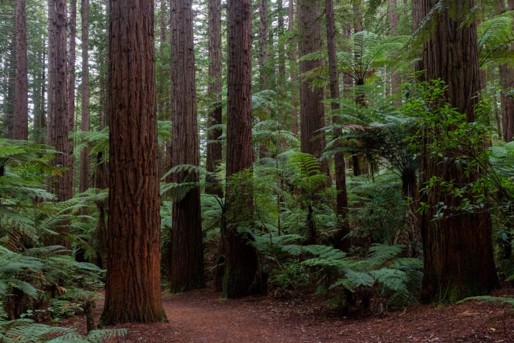
Originally planted in 1901, the Redwood (Whakarewarewa) Forest is made up of 6 hectares of California Redwood trees. This is one of the rare places in the world to experience these gigantic trees.
The Redwoods are located only a 5-minute drive away from Rotorua, which makes it a great activity to do if you are staying in the area. With many biking and walking trails ranging from 30-minutes to several hours, there is plenty to do here to spend a half-day exploring the forest.
One of the best experiences to do in the Redwoods is the Tree Walk where you walk through the forest on a suspended walkway high above the ground. This gives you an incredible vantage point to enjoy the 75-meter tall Redwood trees. The cost per adult is $37.
By Jenoa from One Year Around the World
Lake Waikaremoana
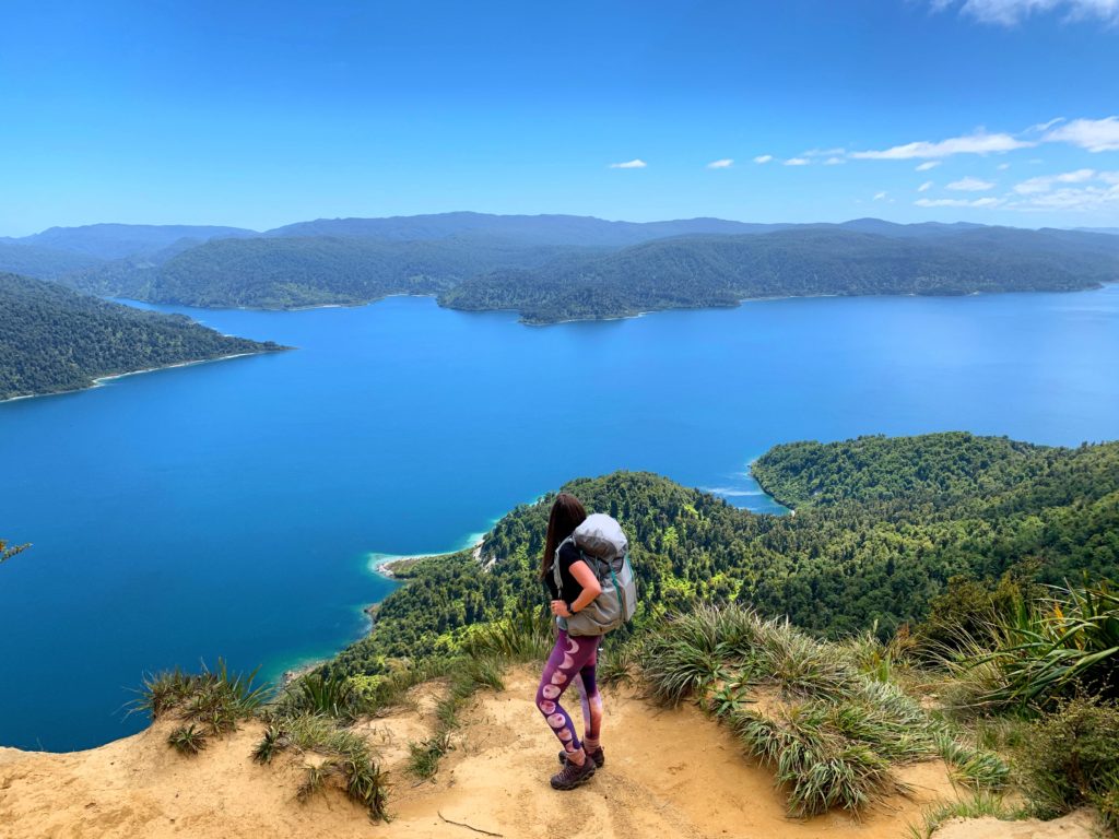
Lake Waikaremoana is located in the northeast of New Zealand’s North Island, and is one of the country’s largest lakes.
It’s an incredibly picturesque part of the world, offering up dense rainforest, spectacular viewpoints, gushing waterfalls, and some of the clearest water around.
Even better: due to its isolated location, few tourists ever bother to make the trek out to the lake. Often, you’ll have some of the country’s best viewpoints all to yourself.
In other words, it’s perfect for sharing on Instagram.
Getting to Lake Waikaremoana can be challenging if you’re not comfortable with tackling gravel roads. There are just two ways to get to the lake: via State Highway 38, either approaching from the north or the south. Whichever direction you choose, you’ll be traversing part of New Zealand’s infamous 90 km gravel road.
The reward is well-worth the effort, however, as once you arrive at the lake, you’ll find yourself with a wealth of hiking trails to beautiful viewpoints.
The most scenic of these is found along the Lake Waikaremoana Great Walk. While the entire trail takes four days to complete, the most Instagrammable view can be reached via a day hike.
SImply head to the car park at Onepoto Bay and then follow the signs up to Panekiri Hut. The ascent will take you up to 600 metres above the lake, where you’ll be greeted by panoramic views of the deepest lake in the country.
By Lauren of Never Ending Footsteps
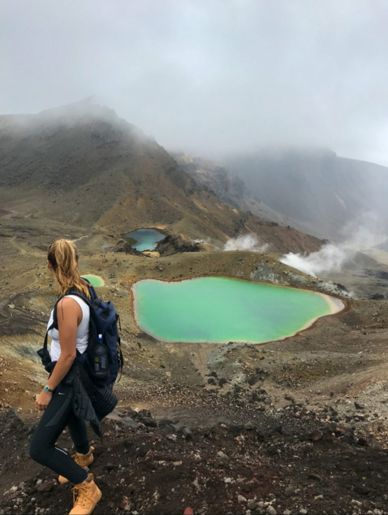
The Emerald Lakes, Tongariro National Park
There are several iconic faces of Tongariro National Park where people come to be astonished by what nature has provided. However, the stunning and wondrous views of the Emerald Lakes in the area, are always a highlight for visitors to the region.
The Emerald Lakes go by the Maori name I Ngarotopounamu, which translates to greenstone-hued lakes. It’s the magical mix of volcanic minerals and sunshine that gives the Emerald Lakes their intense green colour.
The Emerald Lakes are on the Tongariro Alpine Crossing hiking trail and are seen just after you’ve reached the highest point of 1886 m.
The trek to reach the peak is a challenging but picturesque trail, that takes you through active volcanos and, at times, steep climbs. The total duration is 6 hours, starting from Mangatepopo point and finishing at Ketetahi point. The Emerald Lakes are reached approximately halfway through, after 3 hours of walking.
The hike can be completed during the whole year, but since the weather in the area is notoriously shifty you need a guide during winter and the lakes might be covered in snow.
By Josephine Remo
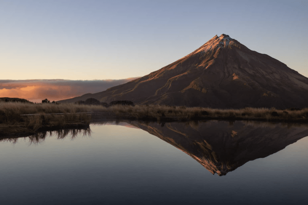
Mount Taranaki via Pouakai Hike
You’ve very likely seen that mega instagrammable spot in New Zealand with a mountain and perfectly placed tarn that mirrors the mountain. It’s a famous location and definitely a must-see when visiting New Zealand, but how do you get there!?
We’re sorry to report that this spot is not going to be an easy one, you’ll have to work for it!
That epic image is Mount Taranaki and the tarn that’s before it requires a hike to get to it. The best way to get here is to do the Pouakai Circut hike and to even spend the night at the Pouakai hut.
Here are the stats of this hike, spoiler alert, it’s a workout!
- Length: 25 km (15.5 miles)
- Difficulty: Hard
- Time: About 14 hours total (over two days if you stay at the hut/camp)
Now you could do this in one grueling day, no doubt! But if you want the best images, you’ll likely want to be here for sunset or sunrise (or both!) which is only possible by staying the night at the hut or camping nearby. The hut itself is about a 20-minute hike from the tarn. There’s a beautiful boardwalk all around the tarn to prance around and get your shots.
Just be sure you’re not wandering off the boardwalks and trails as the terrain here is delicate.
By Nina of Where in the world is Nina?
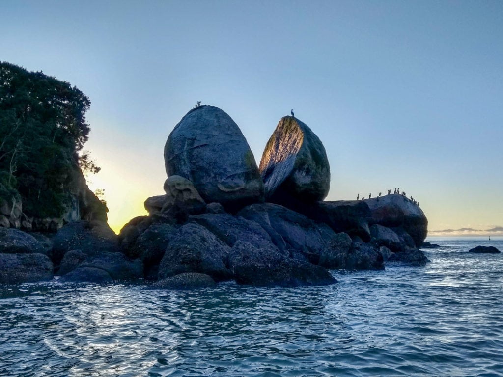
Split Apple Rock, Nelson-Tasman
Split Apple Rock is an unusual rock formation located in the shallow waters of Tasman Bay on New Zealand’s South Island. Nestled between Kaiteriteri and Marahau, two gateway towns to Abel Tasman National Park, it’s a popular natural attraction among tourists.
The rock is made entirely of granite and gets its name from its round shape that looks like it’s been cleaved in half – like an apple cut down the middle. Maori legend has it that the formation was caused by two feuding gods breaking the rock apart.
Some scientists believe it resulted from a natural phenomenon known as ‘ice-wedging’ during an ice age 120 million years ago. This occurs when the water in the rock’s cracks freezes causing it to expand and split open. Water erosion from the sea could have also forced the already cracking granite open over time.
You can reach Split Apple Rock by following a 15-minute walking track via Towers Bay and wading out to it at low tide.
Alternatively, you can see it as part of a scenic nature cruise or kayaking tour from Kaiteriteri Beach. These are the best options as you’re less likely to disturb the birds on the rock.
By Francesca of Little Lost Travel
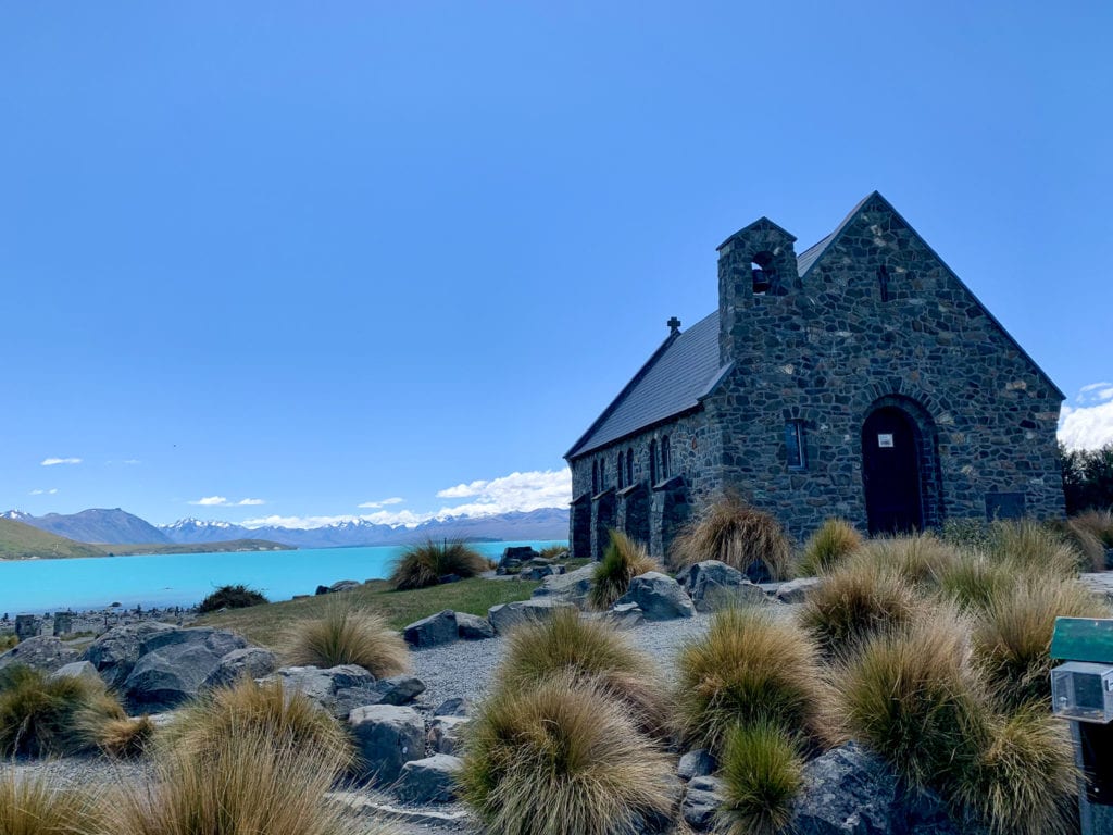
Church of the Good Shepherd, Lake Tekapo
New Zealand might not have the same kind of spectacular cathedrals you see in Europe but it does have one famously beautiful church. The Church of the Good Shepherd is found on the shores of Lake Tekapo, in the South Island, and the small chapel l is the perfect counterpoint to the majestic mountains and vivid blue lake.
The colours of Lake Tekapo have to be seen to be believed, even the photo below looks edited but it really is that blue. If you visit in season, you’ll also get rows of purple lupin lining the lake to make things even prettier.
Lake Tekapo is just under 3 hours drive from Christchurch and is a must-do on any Christchurch-Queenstown road trip. There are also daily buses from Christchurch if you’re travelling New Zealand without a car.
Highway 80, Mount Cook National Park
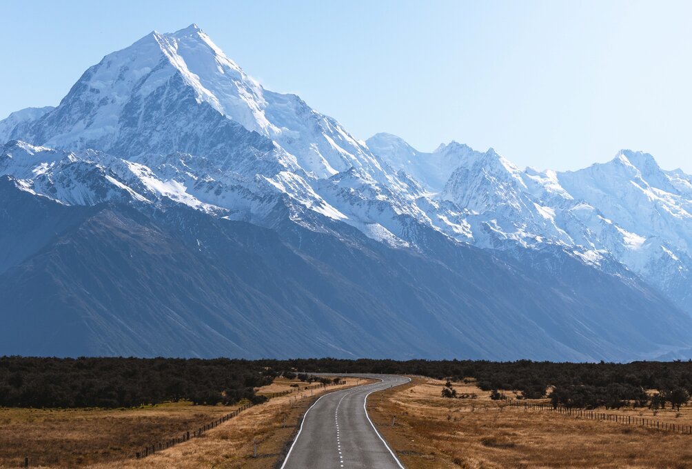
One of the most famous and Instagrammable views in New Zealand can be found on Highway 80 to Mount Cook along the shores of Lake Pukaki. You will follow this highway for about 35 miles along the lake on your way to Mount Cook Village. As you drive this road the mountain will look like it’s right in your face, even though it’s dozens of miles away.
The view is stunning year-round, but for the best chance of good weather, the summer is your best bet for visiting Mount Cook.
There’s one scenic turnout you can stop at, but the best views are right from the road. With the sun shining on the mountain, it can look purely stunning. The road is usually not busy at all, and you can take photos of yourself in the middle of the road, the mountain right behind you.
For the best perspective get the camera right down on the asphalt. You’ll be the envy of your friends with the amazing pictures from the road to Mount Cook!
By Chris of Around The World With Me
Milford Sound
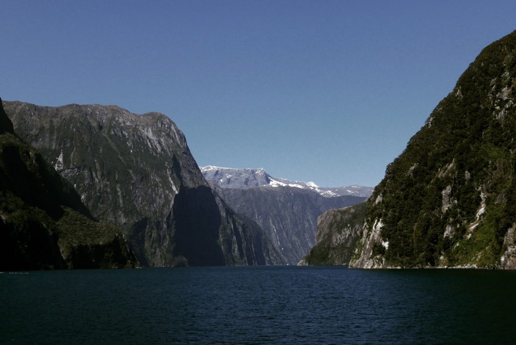
Milford Sound is one of the most iconic natural landmarks on the South Island and the most visited among travellers in Queenstown.
There are different ways to get to Milford Sound: A scenic flight takes about 30 minutes that include a dramatic bird’s-eye view of the surrounding region and Mitre Peak. A bus ride takes about 4 hours, and it is also possible to take a hike on one of the many trekking trails starting from Te Anau.
One of the best ways to experience the otherworldly beauty of Milford Sound is by hopping on a scenic cruise and taking a closer look at the plunging cliffs, raging waterfalls, and wildlife. The cruise takes off at the Milford Sound pier – and since it is located at the deep end of the Sound, it is wonderful to capture the entire Sound.
There are several companies that offer boat tours, from half-day to overnight which you can book through Klook or in person from one of the many agencies in Queenstown.
By Kenny of Knycx Journeying
Wanaka Lavender Farm
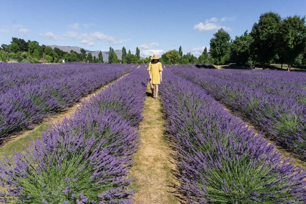
The Wanaka Lavender Farm is the perfect setting for taking instagrammable photos. A lavender field is already a beautiful place, but the family behind the farm know how to make it even more photogenic.
There are 20 acres of fields to wander through, some with mountain backdrops, and props like a door to nowhere, and a purple tractor.
You can also meet the farm animals and shop for lavender and honey products, or enjoy a herbal tea and a lavender ice cream.
Located just 5 minutes drive from the town centre, visiting Wanaka Lavender Farm is easy and while you do need to pay to enter it’s a small fee for the experience and the chance to take some stunning photographs.
The plants will begin to bloom in October and last through to March, but it’s best to visit at the height of the summer to see them all in full bloom. We recommend going early to beat any crowds.
By Sonja of Migrating Miss
Roys Peak, Wanaka
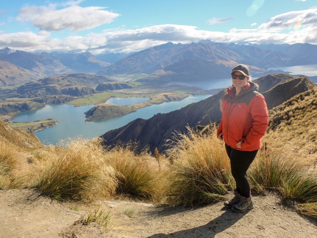
Perhaps the most Instagrammable place in New Zealand, Roys Peak is based in the South Island, in a popular alpine village called Wānaka.
To get to the iconic lookout, you’ll need to walk a steep in-and-out track which is 16km return. Over the course of the walk, you’ll gain approximately 1,500m in elevation. The track itself isn’t much to get excited about but the views certainly are. Towards the end of the trail, the vista is absolutely spectacular, taking in Lake Wānaka and the Southern Alps, including Mount Aspiring.
Though the track is challenging due to its persistent elevation gain, it is achievable for most people – it’s just a matter of taking a little longer as required. The track is exposed to the elements, however, so it is important to be well prepared with sun protection, clothing to suit the conditions and plenty of snacks.
As one of the best Wānaka walks, and with its mind-blowing views, Roys Peak is a must-do on any New Zealand itinerary.
By Sarah of New Zealand Travel Tips
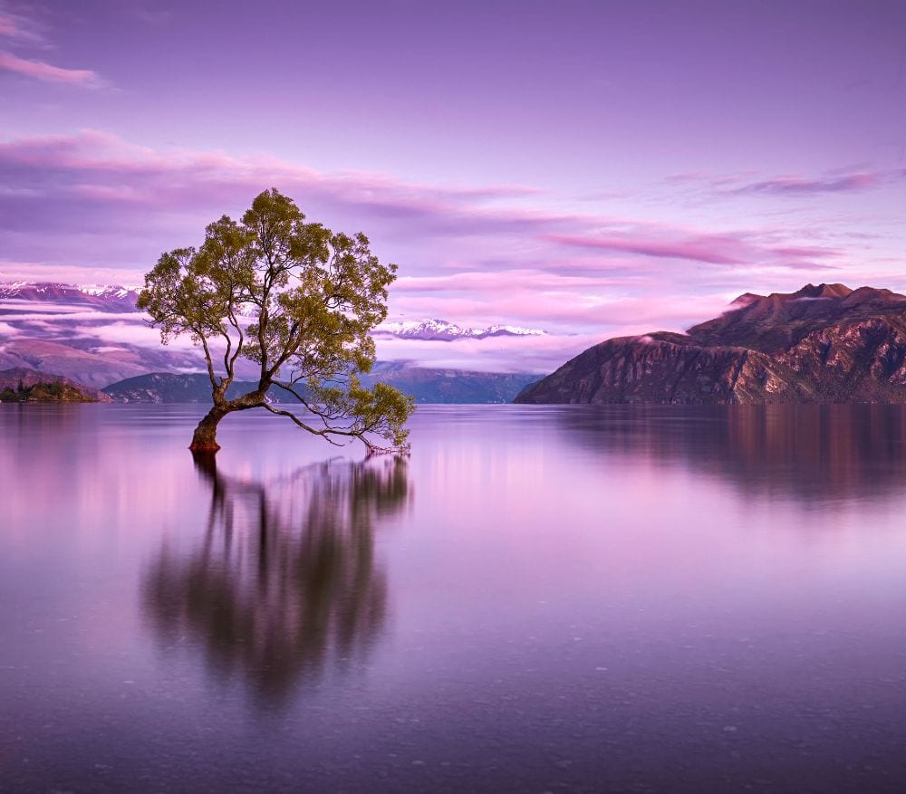
That Wanaka Tree
This lone tree in Wanaka is one of the most visited in New Zealand. It is located in Mount Aspiring National Park where there are many outdoor activities to do.
This area is best for hiking and biking as there are many trails around like the Roys Peak Track, a medium-hard hiking trail (16 km long). If you want to see lagoons, you can hike the Blue Pools Track, another Instagrammable place in New Zealand.
To get to #ThatWanakaTree (yes, it’s a popular hashtag), you can rent a car and drive to Lake Wanaka. The best parking space is the Wanaka Watersports Facility. Once you are there, you can either walk or rent a bike. There is a bicycle trail along Lake Wanaka which is a highly recommended way to see the Wanaka Tree.
The best time to visit Wanaka is from December to mid-March when Wanaka experiences great weather and sunny skies. This is also the summer season in New Zealand (opposite weather with North America) so you can escape the harsh winters in Europe and the US during these months.
By Trisha of PS I’m On My Way
Twelve Mile Delta, Queenstown Lakes
New Zealand’s South Island is peppered with filming locations from Hollywood Blockbusters, especially Lord of the Rings.
A cluster of these can be found in the region of Queenstown, and a road trip around the shores of stunning Lake Wakatipu to Glenorchy offers even more.
Twelve kilometres from Queenstown is Twelve Mile Delta, a location which is the setting for Ithilien in The Two Towers.
From the main road you are directed down to a large camping area from which you can walk to the locations where Sam and Frodo watch the oliphaunts. The campground is the setting for the battle, vantage points not far off the main road offer a shot of the battleground and snow-capped mountains beyond Lake Wakatipu.
By Holly from Globeblogging

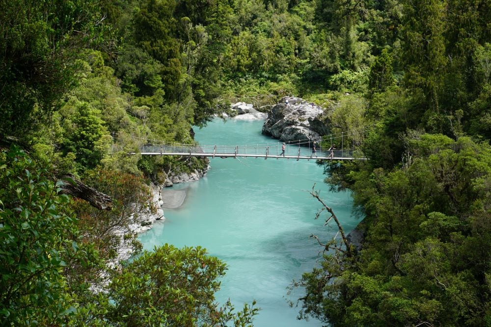
Hokitika Gorge, West Coast
Seeing the turquoise waters of Hokitika Gorge is easily one of the best things to do in Hokitika.
Just half an hour’s drive from Hokitika township, the gorge is surrounded by thick native bush and an easy 2 km loop takes visitors through the trees and down to the blue river.
Take photos on the swing bridges with stunning views across the gorge and make a short detour through a small gate, and walk to the rocks and a small beach at the river below.
Take note of the warning signs, as swimming in the river can be dangerous.
The track is quietest early in the day or late in the afternoon, although the colour of the water tends to be more intense around midday. Avoid visiting after heavy rain as the water looks grey rather than deep blue.
By Roxane of Faraway Worlds
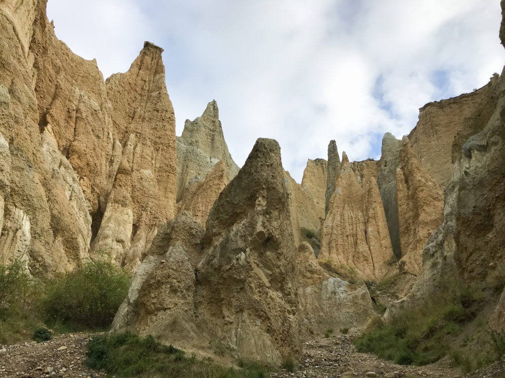
Omarama Clay Cliffs
Omarama Cliffs is one of the best off-the-beaten-track locations in New Zealand for amazing Instagram photos. It’s a secluded location that’s easy to explore while on a road trip on the South Island.
The clay cliffs were naturally formed millions of years ago, with spectacular shapes, and amazing viewpoints from both inside and outside the clay cliffs.
Just make sure to be careful when venturing into the clay cliffs, the path is often slippery with loose rocks.
It’s a 20 minutes drive from Omarama, turn to Quailburn Road off State Highway 8, then keep going until you see Henburn Road for turnoff! The entry is $5 to the donation box. Remember to bring cash for the entry fee!
By Angel of Angel the Wanderlust
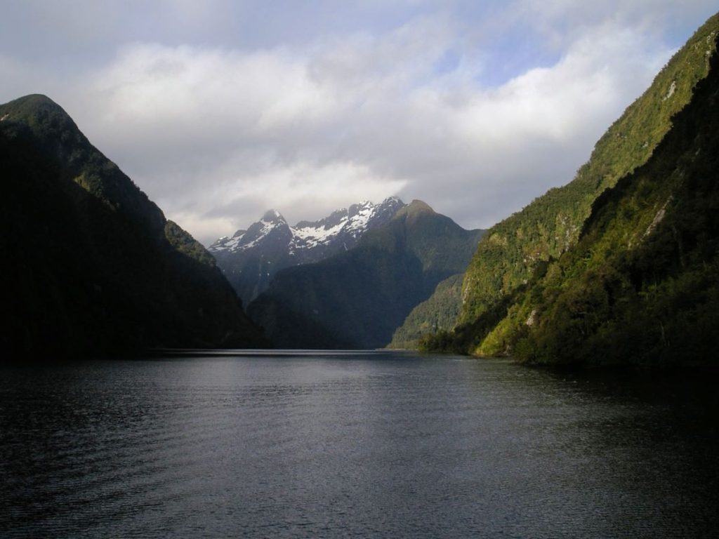
Doubtful Sound
There are many stunning natural landscapes in New Zealand but one of the most beautiful is Doubtful Sound. The deepest of the fjords on the South Island, Doubtful Sound is an untouched wilderness with snow-capped mountains, still waters and soaring cliffs.
On an overnight cruise you’ll visit the most photogenic places, take a kayak out on the misty waters and watch out for bottlenose dolphins, penguins and fur seals.
The photo opportunities are infinite but perhaps the most beautiful part of the Sound is the Hall Arm where waterfalls cascade down the tall cliffs into the still water below. Sunbeams and rainbows in the mist appear from time to time and the early morning sun creates a golden glow that highlights the serenity of pristine Doubtful Sound.
A scenic bus trip across Wilmot Pass will take you from Manapouri to Doubtful Sound to meet your cruise boat or kayak tour.
By Linda of Muy Linda Travels
The post Top 20 Most Instagrammable Photo Locations in New Zealand appeared first on Kate Abroad.

